
No products in the cart.: $0.00

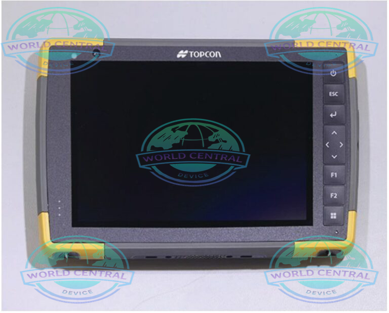
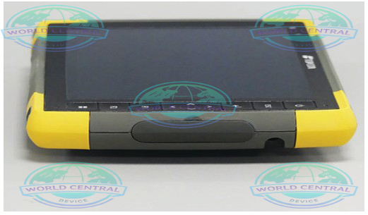
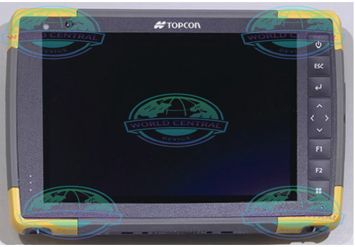
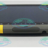
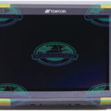
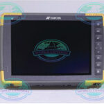
Topcon FC-6400 GNSS Field Controller
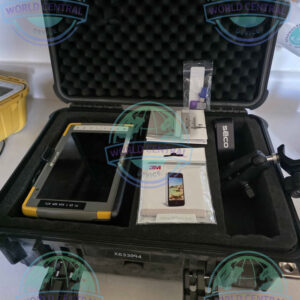
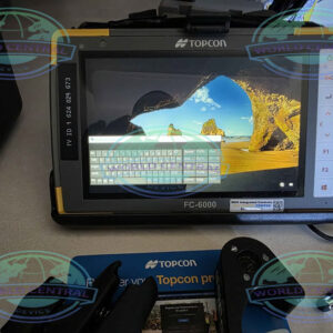
The Topcon FC-6400 GNSS Field Controller is a professional-grade rugged field controller engineered for land surveying, GNSS positioning, GIS data collection, and construction layout. Equipped with Windows® 11 Pro, a powerful Intel® processor, a 7-inch sunlight-readable touchscreen, IP68 and MIL-STD-810H durability, dual hot-swappable batteries
Delivery and return
Delivery and return
Shipping Information
Shipping Information
Composition and care
Composition and care
Description
Topcon FC-6400 GNSS Field Controller
Rugged Windows Field Controller for High-Precision GNSS Surveying and Construction Workflows
The Topcon FC-6400 GNSS Field Controller is a next-generation rugged handheld computer engineered for professional land surveyors, construction engineers, GIS specialists, and mapping professionals. Designed to maximize productivity in challenging field environments, the FC-6400 combines Windows® 11 Pro performance, a high-brightness 7-inch touchscreen, an ergonomic backlit keyboard, and advanced wireless connectivity for seamless operation with GNSS receivers, robotic total stations, laser scanners, and machine control systems.
Built to withstand harsh outdoor conditions, the FC-6400 features an IP68-rated enclosure, MIL-STD-810H certification, and long-lasting dual hot-swappable batteries. Its powerful Intel® processor, ample memory, and enterprise-grade connectivity ensure smooth operation of demanding field applications such as MAGNET Field, Pocket 3D, and third-party Windows surveying software.
Why Choose the Topcon FC-6400?
The FC-6400 is engineered to deliver desktop-class performance in the field while maintaining exceptional durability, connectivity, and user comfort.
Key Features
- Windows® 11 Pro operating system
- Intel® Quad-Core processor
- 7-inch sunlight-readable touchscreen
- IP68 waterproof and dustproof protection
- MIL-STD-810H rugged certification
- Corning® Gorilla® Glass display
- Dual hot-swappable batteries
- Integrated GPS
- Wi-Fi 6 and Bluetooth® 5.x
- Optional 4G LTE modem
- USB Type-C and USB 3.2 connectivity
- High-speed SSD storage
- Ergonomic backlit keyboard
- Compatible with Topcon MAGNET® software
- Optimized for GNSS and robotic total stations
Built for Professional Field Operations
The FC-6400 provides reliable computing power for survey crews working on demanding projects where accuracy and productivity are critical.
Primary Applications
- Land Surveying
- GNSS Data Collection
- Construction Layout
- GIS Mapping
- Utility Surveying
- Infrastructure Inspection
- Mining Survey
- Transportation Projects
- Oil & Gas Survey
- Civil Engineering
- Environmental Monitoring
- Asset Management
Rugged Design for Harsh Environments
Designed specifically for outdoor professionals, the FC-6400 withstands rain, dust, vibration, and extreme temperatures.
Rugged Protection
- IP68 waterproof enclosure
- Dustproof housing
- Shock-resistant construction
- Drop-tested design
- Vibration resistant
- Humidity resistant
- Sunlight-readable display
- Scratch-resistant Gorilla Glass
High-Performance Windows Computing
Powered by a modern Intel® processor and Windows® 11 Pro, the FC-6400 delivers responsive performance for large survey projects.
Performance Benefits
- Fast project loading
- Smooth CAD rendering
- Efficient GIS mapping
- Reliable GNSS communication
- Improved robotic total station control
- Stable multitasking
- Faster report generation
Bright 7-Inch Outdoor Display
The high-resolution touchscreen remains readable even under direct sunlight.
Display Features
- 7-inch capacitive touchscreen
- High-brightness display
- Multi-touch support
- Glove operation
- Wet-touch capability
- Gorilla Glass protection
Advanced Wireless Connectivity
Modern field operations require seamless communication between instruments and office systems.
Connectivity Options
- Wi-Fi 6
- Bluetooth® 5.x
- Optional 4G LTE
- Integrated GPS
- USB Type-C
- USB 3.2
- microSDXC expansion
Long-Lasting Dual Battery System
The FC-6400 is equipped with dual hot-swappable lithium-ion batteries that allow continuous operation without shutting down the controller.
Battery Advantages
- Full-day field operation
- Hot-swappable design
- Reduced downtime
- Extended productivity
- Easy battery replacement
Compatible Survey Equipment
The FC-6400 integrates seamlessly with Topcon positioning solutions.
GNSS Receivers
- HiPer VR
- HiPer HR
- HiPer CR
- HiPer XR
- HiPer SR
Total Stations
- Topcon Robotic Total Stations
- Topcon Manual Total Stations
Laser Scanners
- Topcon Laser Scanning Systems
Machine Control
- Construction positioning systems
- Grade control systems
- Excavator machine control
- Dozer machine guidance
Compatible Software
The Windows platform supports a wide range of professional field software.
Supported Applications
- MAGNET Field
- MAGNET Enterprise
- Pocket 3D
- Topcon Survey Software
- GIS Applications
- CAD Software
- Windows Field Applications
- Third-Party Survey Software
Key Benefits
Improve Survey Productivity
Fast hardware minimizes waiting time and improves field efficiency.
Increase Measurement Accuracy
Reliable communication with GNSS receivers and robotic total stations enhances precision.
Reduce Equipment Downtime
Industrial-grade construction keeps the controller operational in harsh environments.
Simplify Field-to-Office Workflows
Windows compatibility allows easy data synchronization with office applications.
Industries Served
- Land Surveying
- Construction
- Civil Engineering
- Mining
- Oil & Gas
- Utilities
- Transportation
- Railway Infrastructure
- Agriculture
- Government Mapping
- Environmental Services
- Smart City Development
Technical Specifications
| Specification | Details |
|---|---|
| Product Name | Topcon FC-6400 GNSS Field Controller |
| Product Type | Rugged GNSS Field Controller / Data Collector |
| Operating System | Windows® 11 Pro (64-bit) |
| Processor | Intel® Quad-Core Processor |
| CPU Speed | Up to 2.8 GHz (Model Dependent) |
| Graphics | Intel® Integrated Graphics |
| RAM | 8 GB LPDDR4X |
| Internal Storage | 128 GB SSD |
| Expandable Storage | microSDXC |
| Display Size | 7 inches |
| Display Resolution | 1280 × 800 WXGA |
| Display Type | Capacitive Multi-Touch LCD |
| Brightness | Sunlight Readable (Up to 800 nits) |
| Display Protection | Corning Gorilla Glass |
| Touch Modes | Finger, Glove, Wet Touch |
| Keyboard | Backlit Alphanumeric Keyboard |
| Rear Camera | 13 MP Autofocus with LED Flash |
| Front Camera | 5 MP |
| Integrated GNSS | GPS / GLONASS / Galileo / BeiDou (Positioning Support) |
| Wireless LAN | Wi-Fi 6 (802.11 a/b/g/n/ac/ax) |
| Bluetooth | Bluetooth 5.x |
| Cellular | Optional 4G LTE |
| NFC | Optional |
| USB Ports | USB Type-C, USB 3.2 |
| Audio | Integrated Speaker & Microphone |
| Battery Type | Dual Hot-Swappable Lithium-Ion |
| Battery Capacity | Approximately 3,200 mAh each |
| Typical Battery Runtime | Up to 18 Hours |
| Waterproof Rating | IP68 |
| Dustproof Rating | IP68 |
| Military Standard | MIL-STD-810H |
| Drop Resistance | Up to 1.2 m onto Concrete |
| Operating Temperature | -20°C to +60°C |
| Storage Temperature | -30°C to +70°C |
| Humidity | Up to 95% Non-Condensing |
| Dimensions | Approx. 234 × 146 × 36 mm |
| Weight | Approx. 1.0 kg (Including Batteries) |
| Sensors | Accelerometer, Electronic Compass, Gyroscope |
| LED Indicators | Battery, Charging, Communication |
| Security | TPM, Windows Security |
| Software Compatibility | MAGNET Field, Pocket 3D, GIS & CAD Software |
| Instrument Compatibility | GNSS Receivers, Total Stations, Laser Scanners |
| Data Transfer | USB, Wi-Fi, Bluetooth, LTE |

There are no reviews yet.